


A Scandinavian Snake
Interpreting the Snake petroglyph from Tanum, Sweden

This post proposes an explanation to the meaning of the “snake” petroglyph from Tanum, Sweden. Thank you to @serbiaireland for inspiring this post with your excellent thread.
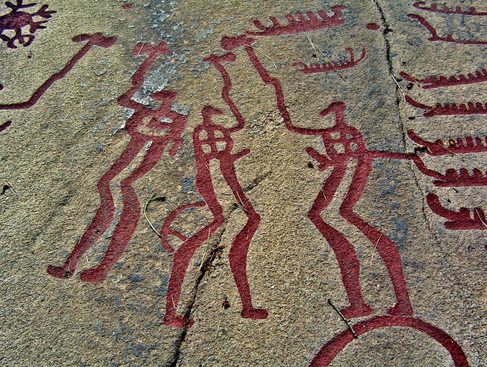
On the western coast of Sweden not far from Norway are the famous Rock Carvings in Tanum. Thousands of petroglyphs depict scenes with axe-men, swordsmen, bowmen, numerous boats, raiding, farming, rituals, and more:
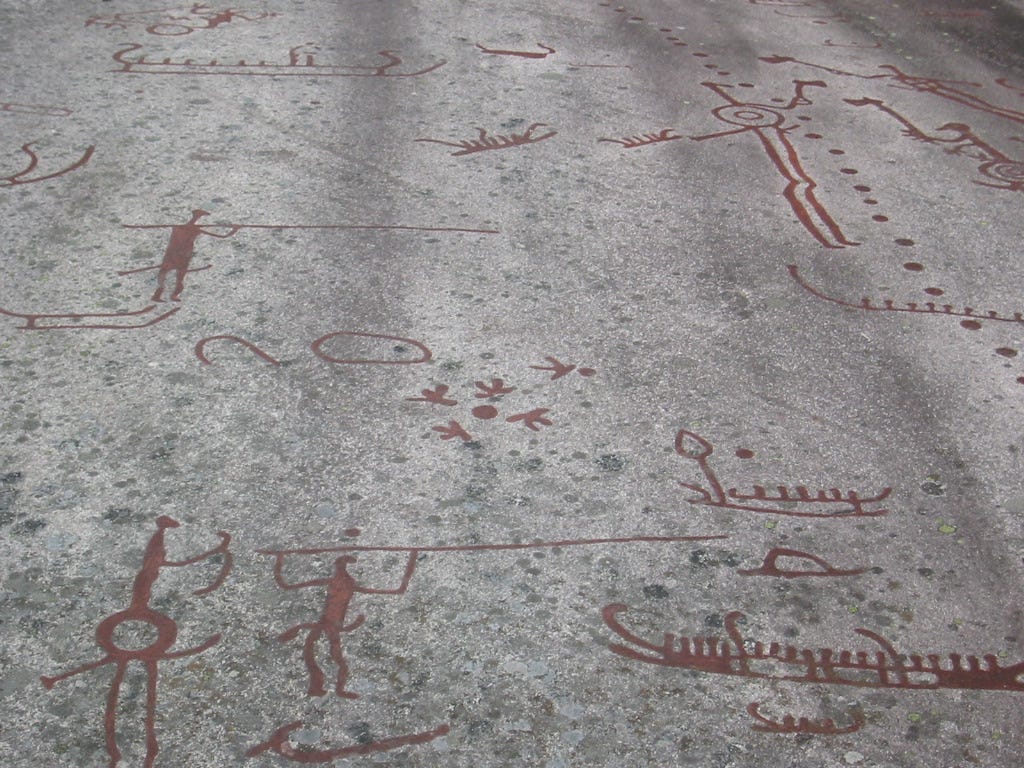
And importantly:

Although many glyphs and scenes are clear in their meaning, the “snake” glyph shown above has eluded consensus. Ideas to explain the “snake” from experts include:
It shows a ‘happy’ man welcoming and/or celebrating the coming of spring, symbolized by the natural phenomena of the springtime emergence of snakes to bask in the sun. The connection between snakes and solar cults is attested historically in many places.
It involves geography: sun over mountains, flowing river, mountain silouhette, etc.
The numerous proposed explanations related to snakes, sun, moon, mountains, ‘happy’ man, etc. encounter difficulty answering one or more important questions:
How does this glyph fit in with the rest of the nearby artwork as part of the story?
Why is the line irregular or inconsistent artistically?
Why are certain features (man, dot, long line) placed where they are in the image?
Proposed meaning
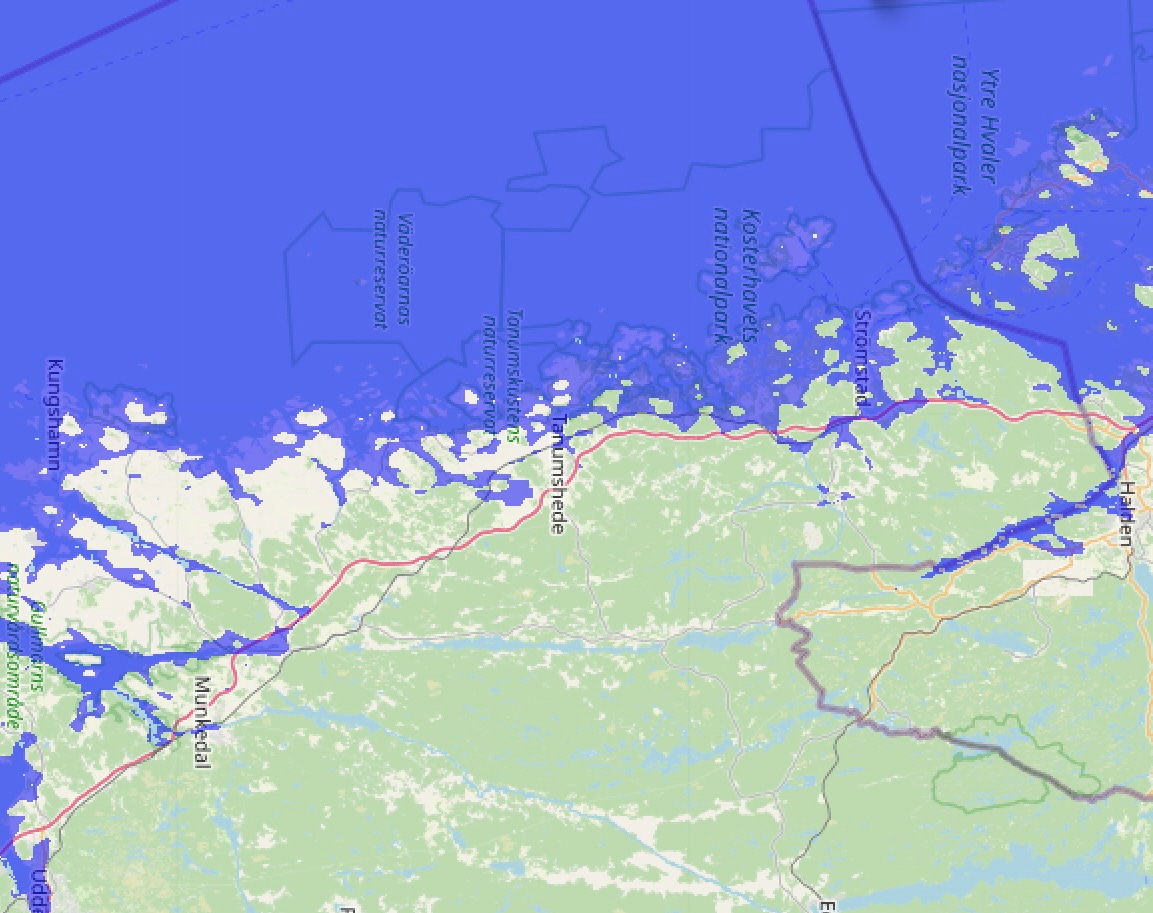
The “snake” glyph is inscribed in Tanum with other artwork as part of the story of the conquest of that area by the boat-borne military-men. The line or “snake” is irregular because it is a map of the ancient coastline near Tanum with the dot representing the notable Koster Islands:
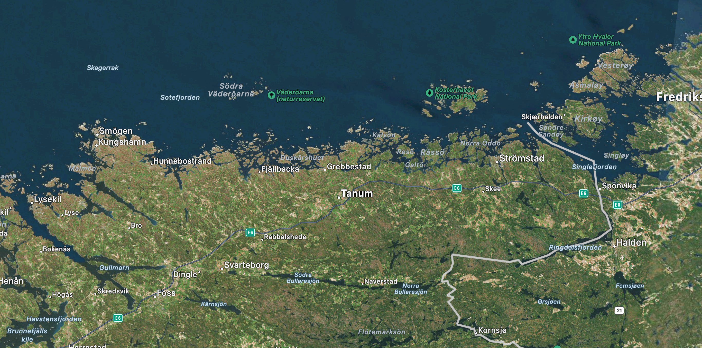
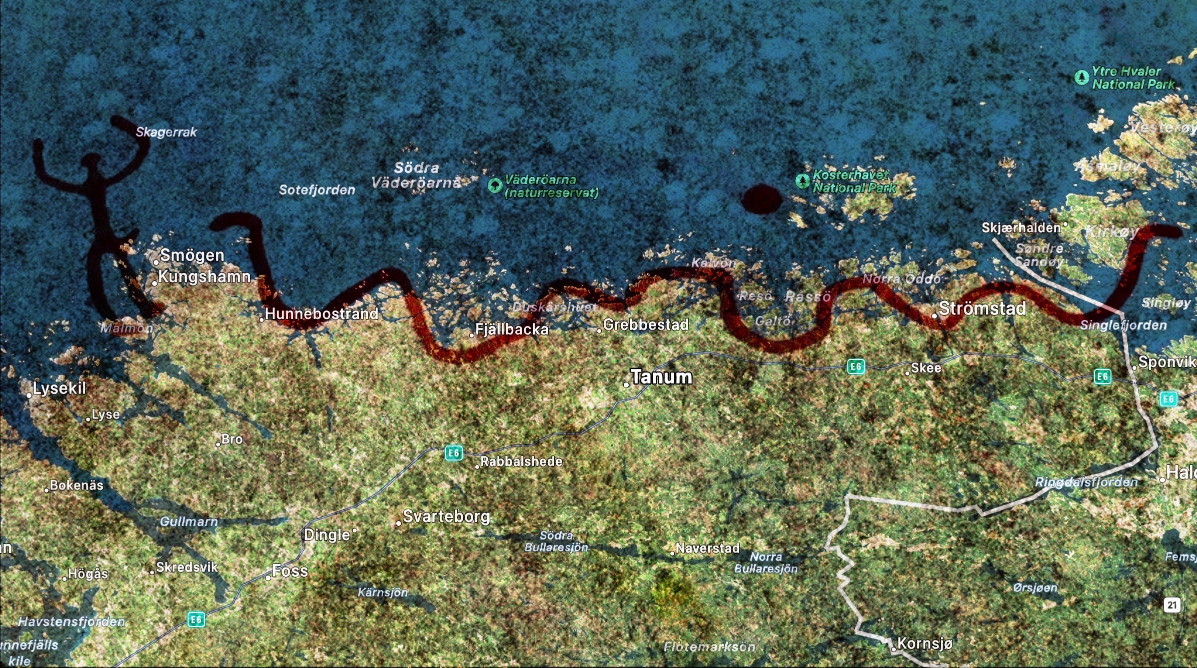
However, water levels may have been up to 25m higher at the time of the glyphs’ inscription, so a map of the coastline with water levels at that height would look like:
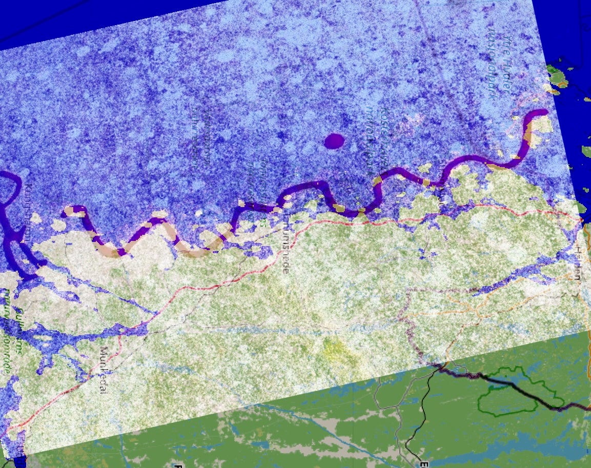
When the “snake” is overlaid on the adjacent coastline, it strongly suggests that this image is a map of the area of activity shown in nearby glyphs.
The man is depicted with his weapon slung through his belt; his placement on the left represents the attackers’ original base of operations in the southern port of Smögen and/or Kungshamn. The line represents an ancient coastline up to 25 meters higher than today. The dot represents the Koster Islands.
There are additional points of note:
The map would be useful for coordinating sea-borne attacks up inlets. Each group of boats could use this map to count how many inlets to pass before sailing inland and disembarking.
Two coordinated forces could sail up inlets #2 and #4 and then march inland towards each other; this would have surrounded the town of Tanum, the center point of the glyph:

To conclude, this proposed explanation can answer all the original questions mentioned earlier:
This glyph is a part of the entire petroglyph artwork of Tanum depicting battle, raiding, and other activities by boat-borne axemen, swordsmen, and others.
The map’s inclusion in the stone carving artwork may attest to its critical role in the attackers’ success as it allowed for a coordinated surrounding or ambush of their foes.
The line is a map of the shoreline.
The placement of the man implies that this was the origin point for the attackers in the south. The line shows the coastline and its inlets. The dot represents the Koster Islands.
Please let me know your thoughts in the comments.
Thank you for reading - Nick DeSoto “Dad in SoCal” 28 February 2024 @18:34
Impressive deduction